
Map of the Week: Map of the Dead
Why we like it: This map is a highly creative and innovative use of the Google Places API and Styled Maps. Also invaluable tool for a “zombie apocalypse.”
When the impending zombie apocalypse is upon us the first thing you need to do is find shelter and supplies. Naturally, your first choice should be the Anti-Zombie Fortress. Unfortunately, Google does not have one on campus and my facilities requests have gone unanswered. Therefore, if you’re like me you’ll just have to make do with something else. Luckily for the rest us of there’s Map of the Dead.
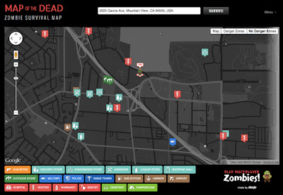
Map of the Dead is designed to help the living survive the zombie apocalypse by locating the nearest points of interest that are relevant to survival and identify the danger areas. The first thing you need to do to use this invaluable tool is to enter your address. The site uses HTML5 Geolocation to tell where you are, but if you need enter an address manually the Google Places Autocomplete API ensures that an address can be quickly populated automatically, saving precious seconds.
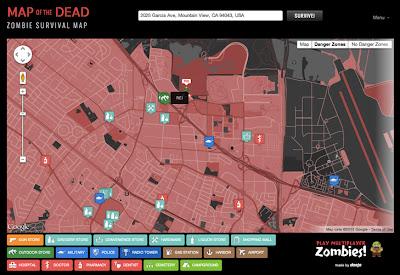
Danger areas are identified on the map using the Styled Maps. Red areas denote where zombies are most likely to roam, while dark areas are typically less populated and therefore less likely to have feeding zombies. After finding shelter, the next most important aspect to surviving the zombie apocalypse is having the right supplies. Using the Google Places API, Map of the Dead displays the most relevant points of interests nearby; such as hospitals, outdoor supply stores, and police stations.
We hope this map has helped you understand how your neighborhood would fare in such a event. Thanks to the developers from Doejo for making this our map of the week!